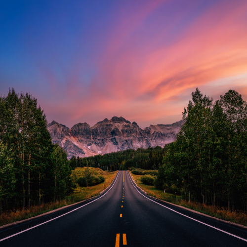
5 Colorado Scenic Byways for Your Next Road Trip
If you’re longing for an exciting road trip, but don’t want to travel out of state for your next adventure, this list of Colorado scenic byways is the perfect way to go. We know there are many reasons you may not want to take a long trip — budget, travel time, taking time off work, finding pet sitters, you name it! Sometimes you want to get away … just not too far away. This list of Colorado scenic byways contains some of the most popular driving routes in the state. You’ll find everything you want to make your drive a wonderful, memorable experience, right here at home in your own backyard.
Peak to Peak Scenic Byway
- Paved
- Free
- Restaurants on Route
- Shopping
- Hiking
- Camping
- Views
The Peak to Peak Scenic Byway is a route located an hour away from Denver and about an hour and 45 minutes away from Colorado Springs via I-25/I-70. It’s a 55-mile route that is completely paved, stretching from Black Hawk to Estes Park along Highway 119 and several other picturesque roads. The route is a popular drive, with plenty of places to stop for lunch or pull over and snap endless photos of the surrounding peaks. Peak to Peak was the state’s first byway, which makes it extra special — and first on our list.
Many drivers choose to start the Peak to Peak Byway in Estes Park. However, the closest starting point for Colorado Springs drivers is over in Black Hawk.
It’s actually an excellent opener for your scenic drive, especially if you’re into history … and the occasional hand of poker. Black Hawk is filled with amazing old buildings and it’s very hard not to be impressed by the sheer rock walls that loom as you navigate the town and its sister Central City.
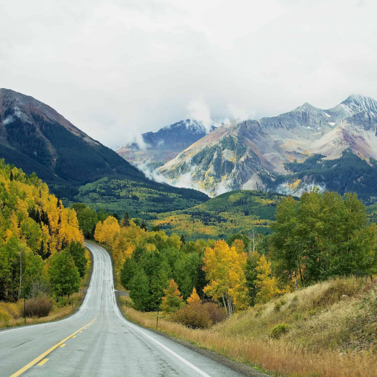
Once you’re on the road, however, it’s all about the mountains. You’ll get unbeatable views of the Continental Divide and the Front Range, not to mention the surrounding forest, waterways and wildflowers. Wildlife is plentiful, so be sure to keep an eye out as you drive and whenever you pull over.
An Easy Drive for All
The nicest feature of the Peak to Peak Scenic Byway is its versatility for every type of Colorado visitor. If you’re a hiking enthusiast, you will find plenty of places to stop and stretch your legs along the route. If you like to shop, dine or enjoy tourist attractions, you’re also in luck. The small towns along the way, as well as the starting and stopping towns of Black Hawk and Estes Park, have plenty for you to do as you drive. The route may only be 55 miles, but it somehow manages to pack a lot to do amongst the mountain views.
Speaking of Estes Park, the Peak to Peak Scenic Highway takes you right to the front door of Rocky Mountain National Park, home of Trail Ridge Road, which is probably the most popular road in the state. If you plan to include Rocky Mountain in your drive, be sure to plan ahead. In the summer, you’ll need to pre-register for timed entry. Please keep in mind that dogs are not allowed in Rocky Mountain, so you may want to skip it if you’ve brought your pup. If you can’t make the park on the day of your drive, there’s also the famous Stanley Hotel, inspiration for The Shining and open for daily tours, ghostly or historic.
Take I-25 north toward Denver. Use exit 194 to CO-470 W. Take C)-470 W for about 26 miles. Take exit 1 onto I-70 W for Grand Junction. Follow I-70 W for 16.5 miles. Use exit 244 for US-6 E. Take US-6 another 3.5 miles to CO-119. Begin your adventure!
The Gold Belt Tour Scenic and Historic Byway
- ! Unpaved PavedSections
- Free
- Restaurants on Route
- Shopping
- Hiking
- Camping
- Views
The Gold Belt Tour takes drivers on a historic journey through the rich mining past of Colorado and the Pikes Peak region. If you follow the complete route, it should take you about five hours to travel all 131 miles. You can start in Cripple Creek itself, but if you want to follow the Gold Belt Tour as it was intended, you’ll need to start in Florissant.
Florissant is a great opening destination because of the Florissant Fossil Beds. The Fossil Beds are home to giant petrified wood stumps and numerous hiking trails (no pets allowed) that explore the geological features of the region. The visit can take about two hours, so be sure to build that plan into your drive.
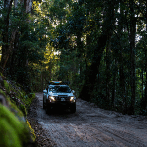
From Florissant, you’ll travel to a fork in the road where you’ll have to make a decision: Do you want to drive the longer paved route and return to Colorado Springs via Highway 50 and Highway 115? Or do you want to take the dirt route via Phantom Canyon Road? If you do not have AWD/4WD and experience navigating offroad terrain, we recommend you take the paved route. The latter has several challenging issues that should not be tackled by first-timers or people in the wrong kind of vehicle.
Offroad Route:
Travel over to Cripple Creek, a historic mining town about 45 minutes from Colorado Springs. If you wanted to skip driving to Florissant first, you could turn left on CO-67 and head straight to Cripple Creek from Highway 24 instead of proceeding to Florissant.
Cripple Creek has several fun attractions, including resident wild donkeys, a real mine shaft you can tour, a scenic open-air train and several small museums. Gambling is legal in the town, too. From Cripple Creek, you will take Phantom Canyon Road or Shelf Road into Florence.
Phantom Canyon Road
Phantom Canyon Road can be challenging, with washboard and ruts and lots of gravel. We do not recommend taking a regular sedan unless you like driving extremely slow or you like driving fast and really want to pay a visit to Honest Accurate in the near future. Despite the difficulties, the route is one of the most beautiful in the state, with several tunnels and bridges, plus interpretive signage and frequent pull-offs.
Shelf Road
Shelf Road is definitely more challenging than Phantom Canyon Road, if only for the five-mile stretch of cliff-hugging dirt road that runs over the creek. If you do have the right vehicle and skills, however, this route is incredibly rewarding for hikers, sightseers and offroad enthusiasts.
Paved Route:
Take High Park Road instead of traveling to Cripple Creek. This route takes you along a rural road filled with sprawling ranches and extended views of the Sangre de Cristo mountains. It’s pretty, paved and easy, no special vehicle required. You can also use this as your return route if you choose to take Shelf Road or Phantom Canyon into Florence.
Speaking of which, Florence is a lovely stop for lunch and exploring. It has an entire street loaded with antique shops and several places to eat, including more than one ice cream shop for that summer sweet tooth. From Florissant, you can take the challenging, one-lane Shelf Road route back to your starting point in Florissant or Cripple Creek, take High Park Road back or cut down through Canon City and use a paved route back to Colorado Springs.
Take Highway 24 West for about 34 miles. Turn left onto Teller County Road 1. Enjoy your drive into Colorado history!
Guanella Pass
- Paved
- Free
- Restaurants on Route
- Shopping
- Hiking
- Camping
- Views
The Guanella Pass Scenic Byway is a short, sweet and easy-to-drive journey that packs a lot of punch in its 22-mile route. Despite the shorter distance, it will still take at least an hour to make the drive from Grant to Georgetown, not including the many places you want to stop and explore.
Guanella Pass has a lot going for it, especially when it comes to water. Both Clear Creek and South Platte start in the region and the lower areas are lush, green and filled with tiny creeks and bodies of water. The higher up you go — and this drive peaks at 11,669 feet at the top of Guanella Pass — the more alpine the terrain becomes. You’ll actually rise above the treeline during your drive, which is a pretty magical experience if you’ve never traveled that high before.
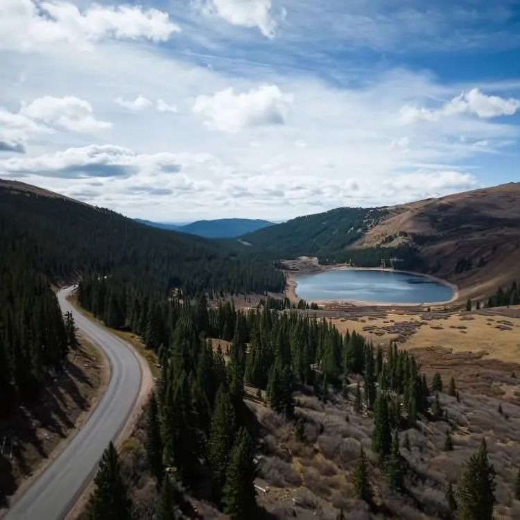
Wildlife is plentiful along this route, so drive with caution. Be sure to stop at some of the points of interest if for photos. You can get a great view of Mount Bierdstadt, as well as Mount Evans. The road weaves through old mining encampments, which offer plenty of great shots, especially if you like rustic buildings and historic structures.
Stop, Shop and Dine in Georgetown
The trip ends in Georgetown, a pretty town with rich history and a community focus on preservation. Many of the buildings and artifacts in this historic mining town have been carefully maintained and restored over the years in order to keep Colorado’s early heritage alive. Check out some of the area attractions to get more in-depth information about the region.
Georgetown also has dining, accommodations and shopping. Since the stretch along the byway is so short, you can definitely plan for time to shop and eat. Check out the Georgetown Loop Railroad if you want a scenic tour that won’t require you to drive. The train includes the chance to tour a silver mine!
Take Highway 24 West for about 52 miles. Turn onto CO-67 N for 25 miles. Turn left onto Highway 285 S. Proceed for 18 miles until you reach Grant. From Grant, follow Guanella Pass Road to Georgetown. Enjoy the drive!
Collegiate Peaks Scenic Byway
- Paved
- Free
- Restaurants on Route
- Shopping
- Hiking
- Camping
- Views
The Collegiate Peaks Scenic Byway is affectionately referred to as the “Avenue of Fourteeners” by Colorado.com and it does indeed contain a multitude of views of plenty of them. The Collegiate Peaks are a chunk of mountains in the Sawatch Range, many named after well-known colleges in the United States. Mount Harvard towers over them all with its whopping 14,421 feet in elevation, plus nine other peaks topping 14,000 feet.
The byway is an exceptionally beautiful drive that begins in Salida. Do not skip out on spending time in Salida if you embark on this byway adventure. Salida is an incredible town that is absolutely filled with art. There’s a bustling downtown district that hosts farmer and art markets on the weekends and several places for dining and drinking. The town’s proximity to Monarch Mountain and affordable skiing has helped it grow into an exciting place to stop and hang for a while.
Most of your drive along the route will be spent gasping at the epic mountains that spike up all around you. The rest will be spent exclaiming over the Arkansas River and surrounding terrain. You’ll see quite a few rafters making their way down the rapids and convening at pull-offs as you drive. If you love to fish and have a license, the river is popular for a variety of fish with multiple stopping points for you to drop your line.
The Route for Hot Springs
This route might be a good one for bringing along a swimsuit. There are hot springs in the towns and in private resorts in the area. The trip ends in Granite. It’s a very small town with a population of just over 100 people. You won’t find a whole lot to do there, but there is a hot spring. Several other busier towns are nearby if you’re looking for more to do after your drive. Alternatively, make your way back to Salida and make a night of it!
Take Highway 115 S out of Colorado Springs and proceed for about 32 miles. In Penrose, take US-50 W toward Canon City and travel 68 miles to Salida. In Salida, take US-50 to Poncha Springs or take CO-291, then take Highway 285 toward Granite.
Silver Thread Scenic Byway
- Paved
- Free
- Restaurants on Route
- Shopping
- Hiking
- Camping
- Views
The Silver Thread Scenic Byway is an exceptional Colorado scenic drive and one that cannot be missed if you are a visitor to the Centennial State. In fact, if you’re a local and you haven’t taken this drive yet, consider this your sign. It has it all — rich geological history, Colorado history, mining, scenic views, hiking, camping, fishing, trains, you name it, the Silver Thread Scenic Byway has it.
The most prominent theme running through this route is the focus on Colorado mining history. It makes sense, considering the only reason roads were even built in those mountains was so that miners could make their fortunes.
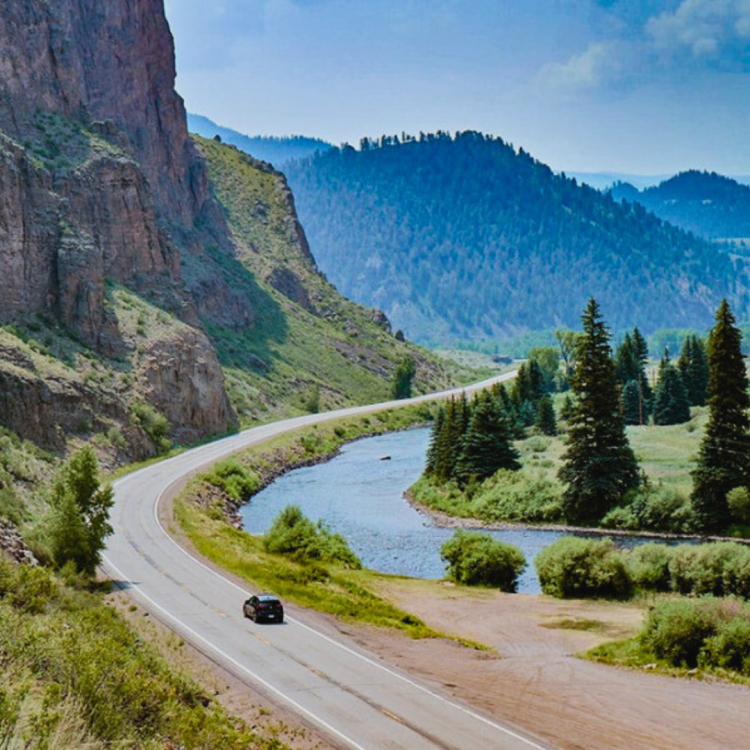
Be sure to check out some of the tours that are located throughout the region. Many of them will take you far down into the mines and share history. Some of the attractions allow you to pick through old mine tailings for your own treasures.
If you prefer immersing yourself in small-town charm, Creede is home to a mining museum and one of the best repertory theaters in the country. Since this drive is so far, consider booking an overnight stay and catching a show! The rest of the town is also a good time, with historic architecture, local dining and lots of shops devoted to souvenirs.
Make a Waterfall Pitstop
As far as geologic and scenic stops go, North Clear Creek Falls is a beautiful surprise that tumbles from the plains into a rocky canyon between Creede and Lake City. The Slumgullion earthflow is another awesome stop, too. It’s a rare geological phenomenon you can check out as you drive down Slumgullion pass on Highway 149.
Take I-25 S for 90 miles to Walsenburg. Take exit 52 onto US-160 W and travel for 118 miles through Alamosa and Monte Vista all the way to South Fork. In South Fork, take CO-149 S toward Creede. Begin your mountain adventure!
Routes with Special Circumstances
The routes below are popular Colorado scenic byways that come with special circumstances.
The Mount Blue Sky Scenic Byway (formerly known as the Mount Evans Scenic Byway)
The Mount Blue Sky Scenic Byway is one of two highways in Colorado that allows you to drive to the summit of a fourteener. The other just so happens to be right here in the beautiful Pikes Peak region — the Pikes Peak Highway. Unfortunately, the road to Mount Blue Sky’s summit is closed at Summit Lake. The closer runs until 2026 while CDOT makes improvements for safety and erosion control. The only routes to the summit are along hiking trails at this time. Please note that hiking to the summit is challenging. Please do not attempt the hike unless you are experienced in wilderness hiking and hiking at extremely high altitudes.
Alpine Loop Scenic Byway (Offroad)
Located in the heart of a cool small town trifecta — Silverton, Ouray and Lake City — Alpine Loop is probably the most popular scenic byway that requires 4WD. Make no mistake about the drive — you need clearance. During the drive you will crest two 12,000-foot passes and enjoy some absolutely stunning views. It’s rugged. Narrow. Rocky. And fun. But that’s only if you heed the warnings about using the right vehicle and you take your time. All three towns offer rental options, so you can even drive your regular vehicle up and hire a guide or rent an OHV.
Getting Your Car Ready for the Road Trip
These routes aren’t particularly strenuous for your vehicle beyond the usual dip in performance that comes with driving at high altitude. However, you definitely want to be ready for a summer on the road before you start daydreaming about destinations. Before you go, here are a few ways to get prepared:
Bring your car in for a summer inspection/service.
Make sure your car is road trip ready with an inspection of all of your key systems.
— Oil change
— Fluid top-off
— Brake check
— Windshield wipers
— Tire check/rotation and spare check
— Belts
Ensure your car emergency kit is packed.
You never know what the road might bring, so bring what you need to tackle the most common challenged.
— Spare tire
— Jack/tire iron
— Water and snacks
— Blankets and spare clothing
— Check out our car emergency checklist for an in-depth list.
Enjoy Your Summer Traveling These Colorado Scenic Byways
Colorado is one of the most beautiful places in the country to take a road trip. These Colorado scenic byways are some of the best ways to do it! We hope you’ll find time to make the journey to as many as possible. Don’t forget to stop in for your pre-drive inspection and keep us in mind if you need help with tune-ups, repairs or upgrades to your vehicle. Happy driving from Honest Accurate Auto Service!
